
Stephen Jackson
Stephen Jackson
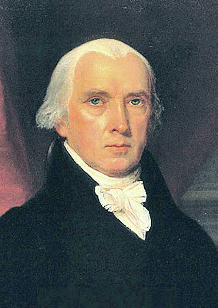
President James Madison
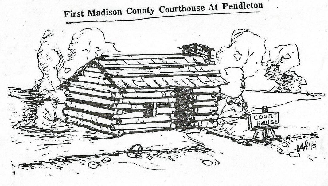
First courthouse of Madison County 1823-27.
By Stephen Jackson | For The TImes-Post
Before Madison County was formally organized on Monday, Nov. 10, 1823, it had been a part of Knox County, the first county established in what became Indiana in 1790.
The organic act stipulated that the new county be given the name Madison, honoring our fourth president, James Madison, who served from 1809-1817.
Eventually there would be five counties in Indiana named for U.S. Presidents.
They are: John Quincy Adams, Thomas Jefferson, James Madison, James Monroe and George Washington.
Added to the total is Harrison County named in 1808 for Indiana Territorial Governor and In Section 3 of the organic act the county commissioners were named.
It also stated in part, “The Commissioners shall meet at the house of William McCartney, in the said new county of Madison to discharge the duties assigned them by law.”
Further on in Section 4 the act stated, “The circuit and other courts of the county of Madison shall meet and be holden at the house of William McCartney, until suitable accommodations can be had at the county seat of said county.”
William McCartney’s two-room log house was in what is today, Pendleton, at the southwest corner of Main and Water streets.
On May 21, 1827, the commissioners met at the John and Sally Berry house located at southeast corner of today’s Central Avenue and 8th Street in Anderson where the wheels were set in motion to relocate the county seat to Andersontown.
On Sept. 1, 1828, the commissioners ordered the construction of a new court house building on property in Andersontown deeded to the county by the Berry’s.
Finally, Jackson County was named in 1816 for the War of 1812 hero and future president, Andrew Jackson.
Twenty-four counties are named for men who had connections to the Revolutionary War, plus three more that were signers of the Declaration of Independence.
Sixteen counties are named for participants in the Battle of Tippecanoe, Nov. 7, 1811.
While another six counties are named for men who were heroes during the War of 1812.
In the beginning, Madison County was much larger than it is today.
There have been five surveys of the county in its history, and each survey altered the boundaries and thus its size.
The first survey was done in 1823 when the county was the largest it would ever be at 592 square miles.
A year later in 1824 the Indiana Legislature reduced the area of Madison County by 150 square miles.
The 1827 legislature decided to re-adjust the boundaries for a third time.
After a number of changes the county was further reduced to 430 square miles with an additional 35 square miles set aside for a portion of the Miami Reserve.
A fourth survey dated April 1, 1831 made more adjustments leaving the square miles of the county at 420.
The fifth and final adjustment came Feb. 17, 1838, when the current boundaries were firmly set making the size of Madison County what it is today at 450 square miles.
All of the surveys were the result of the formal organization of our neighboring counties.
Almost immediately after being formally organized, the Madison County Board began to create civil townships for the purpose of establishing local governing entities subordinate to the county organization.
A number of factors enter into the establishment of a township, one of which is population.
As our county was settled beginning in its southern parts first, that is where the first townships were formed.
In Madison County, we currently have 14 townships.
But, that was not always the case.
One of the oldest records of county board proceedings is dated the January 1829 term.
In those proceedings can be found the names of representatives from five townships being appointed inspectors of elections in and for their respective townships.
The five townships named were: Adams, Anderson, Fall Creek, Green and Jackson.
Obvious from these documented entries is the fact that the five townships had been organized sometime during the first five years-plus of the of the county’s history (Nov. 10, 1823 to January 1829), but in the absence of official records, which it is assumed they were destroyed during the Dec. 10, 1880, burning of the Madison County Courthouse, the exact date of the establishment of each cannot be determined.
Although the log cabin without question is the most recognized image of pioneer Madison County, new villages and towns were equally important.
Towns were necessary to the much larger agricultural community.
Most were primarily economic centers while many also provided political and government services.
There were failed towns also.
Some were bypassed by a new transportation route.
Others suffered intense trade competition from nearby settlements. Madison County towns, past and present, can identify with all these scenarios.
The U.S. Post Office played a role in why some localities were named, or rather why they were not.
For example, the town of New Columbus in Adams Township was called by that name when it was first laid out in 1834.
When a post office was established there in 1837, the post office service required the name be changed in order to avoid confusion with the post office already established at Columbus in Bartholomew County.
The name of Ovid was selected.
Today, postal zip codes have eliminated that problem.
Madison County Historian Stephen Jackson completes with this two-part column a series of “First Sunday” presentations covering the history of Madison County townships and finally the county. The talks took place on the first Sunday each month in the Bowman Room at Museum of Madison County History, 11 W. 11th St., Anderson. The talks began Sept. 4, 2022, and ran through November. The information he prepares for those presentations form the basis of this series of columns in The Times-Post.